
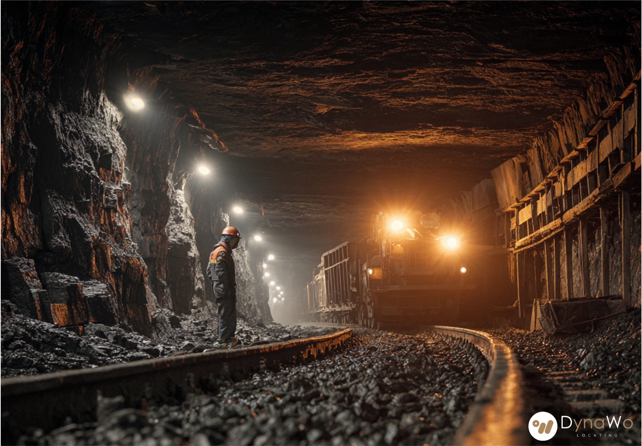
Some workplaces test the limits of safety. Deep underground mines, steel foundries, chemical plants, or offshore rigs — these are environments where visibility is low, heat is high, and the margin for error is thin.
Traditional safety systems rely on line of sight and human judgment, but in these conditions, both are limited. That’s where real-time locating systems (RTLS) become indispensable — not as add-ons, but as lifelines.
In extreme environments, workers are often wrapped in layers of protective gear, surrounded by heavy machinery, and operating where communication can be patchy. RTLS gives them a safety net that never blinks.
By embedding meticulous sensors into tags on helmets, suits, and equipment, each item and person also becomes part of a live network. Anchors placed through tunnels or industrial ceilings map every signal in real time. These tags don’t just track where people and tools are — they measure how they are. Heat, humidity, vibration, or shock data can be transmitted instantly. If a machine overheats or a tool begins to fail, maintenance teams are alerted before breakdowns or injuries occur.
This predictive maintenance also extends to heavy machinery, such as carts transporting rock in mines. If a vibration sensor detects abnormal patterns, it signals that maintenance is due — before the cart stalls mid-route or causes an accident.
In narrow tunnels or dense workshops, worker collision is a constant threat. RTLS proximity alerts can warn workers when another person — or a moving vehicle — is too close, even if visibility is near zero. Vibrations or light signals on the gear can help prevent impact before it happens. In mines, geofences define danger zones: areas where blasting, flooding, or gas buildup may occur. When a worker steps too close, the system sends a real-time warning. Managers above ground can monitor these movements instantly, ensuring that everyone stays within safe limits.
And when the unthinkable happens—a collapse or loss of communication—RTLS becomes a rescue tool. Each tag’s signal helps rescuers locate trapped workers faster, even when visibility and communication are gone. Additional anchors can be deployed rapidly to extend coverage in unstable areas, turning chaos into a map of hope.
No two emergencies unfold the same way. RTLS data enables adaptive evacuation guidance, recommending the safest and fastest routes for each worker based on live conditions. If one tunnel is blocked by debris or gas, workers nearby can be directed automatically to alternate exits. The system updates in real time, adjusting routes as danger levels change. It’s like a living map that thinks, guiding people home through shifting conditions.
Every tag, every anchor, every alert adds a layer of awareness where none existed before. RTLS helps prevent collisions, anticipate failures, speed up rescues, and adapt evacuations — all while keeping transparency and sustainability at the core.
When the environment fights back, RTLS fights with foresight. It doesn’t just show where workers are — it helps bring them back safely.